HTML Area shape Property: Defining Area Shapes in Image Maps
The shape property of the HTML <area> element specifies the geometric shape of the clickable area within an image map. This property, in conjunction with the coords attribute, allows you to define precise regions on an image that act as hyperlinks. By setting the shape property, you can create interactive image maps where different parts of an image link to different URLs.
Purpose of the shape Property
The shape property enables the creation of custom clickable areas within an image map. This is useful for:
- Creating non-rectangular hotspots on an image.
- Defining complex regions for interactive infographics.
- Enhancing user experience by providing intuitive navigation within an image.
Syntax
The shape property is set as an attribute of the <area> element:
<area shape="value" coords="coordinates" href="url" alt="description">
Values
The shape property accepts the following values:
| Value | Description |
|---|---|
| `rect` | Defines a rectangular area. Requires four coordinates: `x1, y1, x2, y2`, where `(x1, y1)` is the top-left corner and `(x2, y2)` is the bottom-right corner. |
| `circle` | Defines a circular area. Requires three coordinates: `cx, cy, radius`, where `(cx, cy)` is the center of the circle and `radius` is the radius. |
| `poly` | Defines a polygonal area. Requires a series of `x, y` coordinate pairs that define the vertices of the polygon. Example: `x1, y1, x2, y2, x3, y3, …`. |
| `default` | Specifies the entire image as the clickable area. If no other shapes are defined, this will be the fallback, or it can define a final catch-all area. |
Examples
Let’s explore some practical examples of how to use the shape property with different values.
Example 1: Rectangular Area
This example demonstrates how to create a rectangular clickable area on an image.
<img src="https://dummyimage.com/200x200/0074D9/fff" alt="Rectangle Image" usemap="#rectangleMap">

<map name="rectangleMap">
  <area shape="rect" coords="20,20,180,180" href="https://www.example.com/rectangle" alt="Rectangle Link">
</map>
In this example, the shape is set to rect, and the coords attribute defines a rectangle from (20, 20) to (180, 180). Clicking within this rectangle will navigate to https://www.example.com/rectangle.
Example 2: Circular Area
This example demonstrates how to create a circular clickable area on an image.
<img src="https://dummyimage.com/200x200/2ECC40/fff" alt="Circle Image" usemap="#circleMap">

<map name="circleMap">
  <area shape="circle" coords="100,100,80" href="https://www.example.com/circle" alt="Circle Link">
</map>
In this example, the shape is set to circle, and the coords attribute defines a circle with its center at (100, 100) and a radius of 80. Clicking within this circle will navigate to https://www.example.com/circle.
Example 3: Polygonal Area
This example demonstrates how to create a polygonal clickable area on an image.
<img src="https://dummyimage.com/200x200/FF4136/fff" alt="Polygon Image" usemap="#polygonMap">

<map name="polygonMap">
  <area shape="poly" coords="50,20,150,20,180,100,150,180,50,180,20,100" href="https://www.example.com/polygon" alt="Polygon Link">
</map>
In this example, the shape is set to poly, and the coords attribute defines a polygon with six vertices. Clicking within this polygon will navigate to https://www.example.com/polygon.
Example 4: Default Area
This example demonstrates how to define a default area for an image map. If the user clicks anywhere outside of the areas defined by the rect, circle, and poly tags, they will navigate to the default URL.
<img src="https://dummyimage.com/200x200/FFDC00/000" alt="Mixed Shapes Image" usemap="#mixedMap">

<map name="mixedMap">
  <area shape="rect" coords="20,20,80,80" href="https://www.example.com/rect" alt="Rectangle Link">
  <area shape="circle" coords="150,50,30" href="https://www.example.com/circle" alt="Circle Link">
  <area shape="poly" coords="50,120,70,180,130,180,150,120" href="https://www.example.com/polygon" alt="Polygon Link">
  <area shape="default" href="https://www.example.com/default" alt="Default Link">
</map>
In this example, multiple shapes are defined with their respective links. If a user clicks outside of any of these defined shapes, they will navigate to the URL specified in the default area tag i.e. https://www.example.com/default.
Practical Use Case: Interactive World Map
Let’s create an interactive world map where different continents are clickable and link to relevant information pages.
<img src="https://upload.wikimedia.org/wikipedia/commons/thumb/a/aa/Physical_world_map_blank.svg/1280px-Physical_world_map_blank.svg.png" alt="World Map" usemap="#worldMap" width="600">

<map name="worldMap">
  <area shape="poly" coords="260,170,310,130,360,150,380,220,340,280,280,250" href="https://www.example.com/europe" alt="Europe">
  <area shape="poly" coords="420,200,480,180,520,250,500,320,440,300" href="https://www.example.com/asia" alt="Asia">
  <area shape="poly" coords="100,250,180,220,220,300,180,380,100,350" href="https://www.example.com/africa" alt="Africa">
  <area shape="poly" coords="100,100,150,80,200,150,150,220,100,180" href="https://www.example.com/northamerica" alt="North America">
  <area shape="poly" coords="100,400,150,380,200,450,150,520,100,480" href="https://www.example.com/southamerica" alt="South America">
  <area shape="poly" coords="400,500,450,480,500,550,450,620,400,580" href="https://www.example.com/australia" alt="Australia">
</map>
In this example, a world map image is used, and each continent is defined as a polygonal area. Clicking on a continent will redirect the user to a specific page containing information about that continent.
Tips and Best Practices
- Use descriptive
altattributes: Always provide meaningfulaltattributes for the<area>elements to improve accessibility. - Test thoroughly: Ensure that the clickable areas are accurately defined and that the links work correctly across different browsers.
- Consider responsiveness: Image maps may require adjustments for different screen sizes. Consider using JavaScript to dynamically adjust the coordinates based on the screen size.
- Provide visual cues: Use CSS to highlight the clickable areas on hover, providing a visual indication to the user.
Browser Support
The shape property of the <area> element is widely supported across all modern web browsers.
Conclusion
The shape property of the HTML <area> element is a powerful tool for creating interactive image maps. By defining precise shapes for clickable areas, you can enhance user engagement and provide intuitive navigation within images. Whether you’re creating interactive infographics or custom navigation systems, mastering the shape property is essential for modern web development.
Related Posts
HTML Area Tag: Creating Clickable Areas in Image Maps
HTML <area> Tag The <area> tag defines a clickable area within an image map. It is always nested inside a...
HTML Area coords Property: Area Coordinates
HTML Area coords Property: Defining Clickable Regions The HTML coords property of the <area> element specifies the coordinates of the...
HTML Area href Property: Area URL
HTML Area href Property: Defining Area URLs The HTML Area href property specifies the URL that the area within an...
HTML Object useMap Property: Object Use Map
HTML object useMap Property: Linking Objects to Image Maps The useMap attribute in the HTML <object> tag is used to...

HTML Map name Property: Map Name
HTML Map name Property: Creating Interactive Image Maps The HTML <map> element, combined with the name property, is used to...
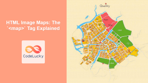
HTML Image Maps: The `<map>` Tag Explained
HTML <map> Tag The <map> tag in HTML is used to define a client-side image map. An image map allows...

HTML DOM Area Object: Accessing Area Elements
HTML DOM Area Object: Accessing and Manipulating Area Elements The HTML DOM area object represents an <area> element in HTML....
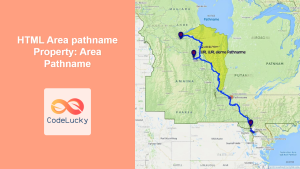
HTML Area pathname Property: Area Pathname
HTML Area pathname Property: Understanding the Path Segment of a URL The pathname property of the HTML <a> (area) element...
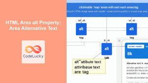
HTML Area alt Property: Area Alternative Text
HTML Area alt Property: Alternative Text for Image Map Areas The HTML <area> tag, used within <map> to define clickable...
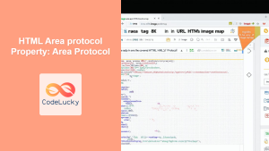
HTML Area protocol Property: Area Protocol
HTML Area protocol Property: Understanding the Protocol of an Area Link The protocol property of the HTML <a> (anchor) element,...

HTML DOM Map Object: Accessing Image Map Elements
HTML DOM Map Object: Interacting with Image Maps The HTML DOM Map object provides an interface to interact with HTML...

HTML Map Areas Collection: Accessing Area Elements
HTML Map Areas Collection: Accessing Area Elements in JavaScript The areas collection in HTML provides a way to access all...