JavaScript Geolocation Coordinates Property: The Coordinates Object
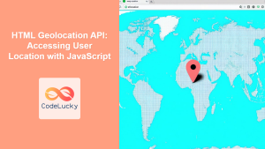
The JavaScript Geolocation API allows web applications to access the user’s location with their permission. The Coordinates object, accessed through the coords property of the GeolocationPosition object, provides specific details about the user’s location, such as latitude, longitude, altitude, and accuracy. This guide explores the properties of the Coordinates object and how to effectively use them to enhance your web applications.
What is the Coordinates Object?
The Coordinates object is a crucial component of the Geolocation API, encapsulating geographical data retrieved from the user’s device. It provides essential properties that describe the user’s current location, accuracy, and, if available, altitude and speed.
Purpose of the Coordinates Object
The primary purpose of the Coordinates object is to provide developers with a structured way to access location data, enabling location-aware features such as mapping, navigation, and location-based services.
Syntax
The Coordinates object is accessed as a property of the GeolocationPosition object returned by the getCurrentPosition() or watchPosition() methods of the Geolocation API.
navigator.geolocation.getCurrentPosition(
  function (position) {
    const latitude = position.coords.latitude;
    const longitude = position.coords.longitude;
    // ... access other properties
  },
  function (error) {
    // Handle errors
  }
);
Properties of the Coordinates Object
The Coordinates object includes several key properties that provide detailed information about the user’s location.
| Property | Type | Description |
|---|---|---|
| `latitude` | Number | The latitude in decimal degrees. |
| `longitude` | Number | The longitude in decimal degrees. |
| `altitude` | Number | The altitude in meters above the WGS 84 reference ellipsoid. Can be `null` if unavailable. |
| `accuracy` | Number | The accuracy of the latitude and longitude in meters. |
| `altitudeAccuracy` | Number | The accuracy of the altitude in meters. Can be `null` if unavailable. |
| `heading` | Number | The direction of travel in degrees counting clockwise relative to true north. Can be `null` if unavailable. |
| `speed` | Number | The device’s speed in meters per second. Can be `null` if unavailable. |
Examples
Let’s explore some examples of how to use the Coordinates object to access location data.
Basic Example: Getting Latitude and Longitude
This example demonstrates how to retrieve the latitude and longitude from the Coordinates object.
<!DOCTYPE html>
<html>
  <head>
    <title>Geolocation Example</title>
  </head>
  <body>
    <p>Click the button to get your coordinates:</p>
    <button onclick="getLocation1()">Get Location</button>
    <p id="locationData1"></p>

    <script>
      function getLocation1() {
        if (navigator.geolocation) {
          navigator.geolocation.getCurrentPosition(showPosition1, showError1);
        } else {
          document.getElementById("locationData1").innerHTML =
            "Geolocation is not supported by this browser.";
        }
      }

      function showPosition1(position) {
        const latitude = position.coords.latitude;
        const longitude = position.coords.longitude;
        document.getElementById("locationData1").innerHTML =
          "Latitude: " + latitude + "<br>Longitude: " + longitude;
      }

      function showError1(error) {
        switch (error.code) {
          case error.PERMISSION_DENIED:
            document.getElementById("locationData1").innerHTML =
              "User denied the request for Geolocation.";
            break;
          case error.POSITION_UNAVAILABLE:
            document.getElementById("locationData1").innerHTML =
              "Location information is unavailable.";
            break;
          case error.TIMEOUT:
            document.getElementById("locationData1").innerHTML =
              "The request to get user location timed out.";
            break;
          case error.UNKNOWN_ERROR:
            document.getElementById("locationData1").innerHTML =
              "An unknown error occurred.";
            break;
        }
      }
    </script>
  </body>
</html>
Output:
After clicking the “Get Location” button and granting permission, the latitude and longitude coordinates will be displayed.
Displaying All Available Coordinates Data
This example shows how to access and display all properties of the Coordinates object.
<!DOCTYPE html>
<html>
  <head>
    <title>Geolocation Example</title>
  </head>
  <body>
    <p>Click the button to get detailed location information:</p>
    <button onclick="getLocation2()">Get Detailed Location</button>
    <p id="locationData2"></p>

    <script>
      function getLocation2() {
        if (navigator.geolocation) {
          navigator.geolocation.getCurrentPosition(showPosition2, showError2);
        } else {
          document.getElementById("locationData2").innerHTML =
            "Geolocation is not supported by this browser.";
        }
      }

      function showPosition2(position) {
        const coords = position.coords;
        let output = "Latitude: " + coords.latitude + "<br>";
        output += "Longitude: " + coords.longitude + "<br>";
        output += "Accuracy: " + coords.accuracy + " meters<br>";
        if (coords.altitude !== null) {
          output += "Altitude: " + coords.altitude + " meters<br>";
          output +=
            "Altitude Accuracy: " + coords.altitudeAccuracy + " meters<br>";
        }
        if (coords.heading !== null) {
          output += "Heading: " + coords.heading + " degrees<br>";
        }
        if (coords.speed !== null) {
          output += "Speed: " + coords.speed + " meters/second<br>";
        }
        document.getElementById("locationData2").innerHTML = output;
      }

      function showError2(error) {
        switch (error.code) {
          case error.PERMISSION_DENIED:
            document.getElementById("locationData2").innerHTML =
              "User denied the request for Geolocation.";
            break;
          case error.POSITION_UNAVAILABLE:
            document.getElementById("locationData2").innerHTML =
              "Location information is unavailable.";
            break;
          case error.TIMEOUT:
            document.getElementById("locationData2").innerHTML =
              "The request to get user location timed out.";
            break;
          case error.UNKNOWN_ERROR:
            document.getElementById("locationData2").innerHTML =
              "An unknown error occurred.";
            break;
        }
      }
    </script>
  </body>
</html>
Output:
After clicking the button and granting permission, detailed location information including latitude, longitude, accuracy, altitude, heading, and speed (if available) will be displayed.
Using Coordinates with Google Maps
This example integrates the Coordinates object with Google Maps to display the user’s location on a map.
<!DOCTYPE html>
<html>
  <head>
    <title>Geolocation with Google Maps</title>
    <style>
      #mapCanvas3 {
        width: 400px;
        height: 300px;
      }
    </style>
  </head>
  <body>
    <p>Click the button to show your location on Google Maps:</p>
    <button onclick="getLocation3()">Show on Map</button>
    <div id="mapCanvas3"></div>

    <script>
      let map3;

      function getLocation3() {
        if (navigator.geolocation) {
          navigator.geolocation.getCurrentPosition(showMap3, showError3);
        } else {
          document.getElementById("mapCanvas3").innerHTML =
            "Geolocation is not supported by this browser.";
        }
      }

      function showMap3(position) {
        const latitude = position.coords.latitude;
        const longitude = position.coords.longitude;
        const latLng = { lat: latitude, lng: longitude };

        map3 = new google.maps.Map(document.getElementById("mapCanvas3"), {
          center: latLng,
          zoom: 12,
        });

        new google.maps.Marker({
          position: latLng,
          map: map3,
          title: "Your Location",
        });
      }

      function showError3(error) {
        switch (error.code) {
          case error.PERMISSION_DENIED:
            document.getElementById("mapCanvas3").innerHTML =
              "User denied the request for Geolocation.";
            break;
          case error.POSITION_UNAVAILABLE:
            document.getElementById("mapCanvas3").innerHTML =
              "Location information is unavailable.";
            break;
          case error.TIMEOUT:
            document.getElementById("mapCanvas3").innerHTML =
              "The request to get user location timed out.";
            break;
          case error.UNKNOWN_ERROR:
            document.getElementById("mapCanvas3").innerHTML =
              "An unknown error occurred.";
            break;
        }
      }
    </script>
    <script
      async
      src="https://maps.googleapis.com/maps/api/js?key=YOUR_API_KEY&callback=initMap"
    ></script>
  </body>
</html>
Note: Replace YOUR_API_KEY with your actual Google Maps API key. 🔑
Output:
After clicking the button and granting permission, a Google Map will be displayed with a marker indicating the user’s current location.
Tracking Location Changes
This example uses watchPosition() to continuously monitor and display changes in the user’s location.
<!DOCTYPE html>
<html>
  <head>
    <title>Geolocation Tracking</title>
  </head>
  <body>
    <p>Tracking your location:</p>
    <p id="locationData4"></p>

    <script>
      let watchId4;

      function startTracking4() {
        if (navigator.geolocation) {
          watchId4 = navigator.geolocation.watchPosition(
            showPosition4,
            showError4
          );
        } else {
          document.getElementById("locationData4").innerHTML =
            "Geolocation is not supported by this browser.";
        }
      }

      function showPosition4(position) {
        const latitude = position.coords.latitude;
        const longitude = position.coords.longitude;
        document.getElementById("locationData4").innerHTML =
          "Latitude: " + latitude + "<br>Longitude: " + longitude;
      }

      function showError4(error) {
        switch (error.code) {
          case error.PERMISSION_DENIED:
            document.getElementById("locationData4").innerHTML =
              "User denied the request for Geolocation.";
            break;
          case error.POSITION_UNAVAILABLE:
            document.getElementById("locationData4").innerHTML =
              "Location information is unavailable.";
            break;
          case error.TIMEOUT:
            document.getElementById("locationData4").innerHTML =
              "The request to get user location timed out.";
            break;
          case error.UNKNOWN_ERROR:
            document.getElementById("locationData4").innerHTML =
              "An unknown error occurred.";
            break;
        }
      }

      startTracking4(); // Start tracking as soon as the page loads
    </script>
  </body>
</html>
Output:
The latitude and longitude coordinates will be continuously updated as the user’s location changes.
Tips and Best Practices
- Handle Errors Gracefully: Always include error handling to manage cases where the user denies permission or location data is unavailable.
- Respect User Privacy: Clearly communicate why you need the user’s location and how it will be used.
- Use HTTPS: Geolocation API requires a secure context, so your site must be served over HTTPS.
- Consider Accuracy: Use the
accuracyproperty to determine the reliability of the location data. - Optimize Performance: Avoid unnecessary calls to
getCurrentPosition()orwatchPosition()to conserve battery life.
Real-World Applications
The Coordinates object enables various real-world applications, including:
- Mapping and Navigation: Displaying the user’s location on a map and providing directions.
- Location-Based Services: Offering services based on the user’s location, such as nearby restaurants or stores.
- Geotagging: Adding location information to photos or other media.
- Fitness Tracking: Monitoring and recording the user’s movement during physical activities.
Browser Support
The Geolocation API, including the Coordinates object, is supported by all modern web browsers.
Note: Always test your implementation across different browsers and devices to ensure compatibility and a consistent user experience. 🧐
Conclusion
The JavaScript Geolocation Coordinates object is essential for accessing detailed location information within web applications. By understanding its properties and how to use them effectively, you can create compelling location-aware features that enhance the user experience. Whether you’re building mapping applications, location-based services, or fitness trackers, the Coordinates object provides the necessary data to bring your ideas to life.


